Group1: Google Earth: Benefits versus Privacy

Contents
Introduction
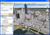
Google Earth is a geographic information program, or simply put, a digital map. It is a virtual globe showing different views of the Earth's surface. The program was initially created by Keyhole Incorporation, a company acquired by Google in the year 2004. Google Earth maps the planet by superimposing a number of images obtained from satellites, aerial photography and the Geographic Information System 3D globe.
Overview of Technology
How to download:
Google Earth can be easily downloaded from the official Google Earth download website.
How Google Earth works:
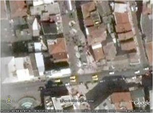
Google Earth presents satellite images to users upon entering exact addresses into the search engine. Users can simply type an address and press enter. Once located, Google Earth allows the user to zoom into the exact location and provides images. Users are also able to explore the virtual Google Earth globe freely, by clicking on any desired area on the map and zooming in.
Google earth is available in three different versions:
1. Google Earth Free version
The free version enables users to search for images, maps and view 3D buildings.
2. Google Earth Plus
Google Earth Plus is an upgraded version of the Google Earth Free version. It enables users to plug in their GPS systems and plan their travel routes. It also allows them to obtain higher resolution prints.
3. Google Earth Pro
Google Earth Pro is intended for commercial use, and provides a professional tool for businesses that deal heavily with geographical information.
Minimum system requirements:
•Windows 2000/ XP or above
•CPU: Pentium 3,500 MHz
•128 MB RAM
•12.7 MB free disk space (400 MB for Linux)
•Network speed: 128 Kbit/sec
•16MB 3D-capable graphics card
•Resolution of 1024x768, 16-bit High Color
The Layers of Google Earth
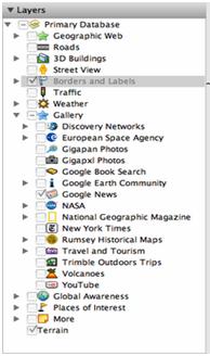
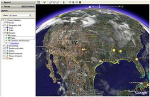
One of the single most essential features of Google Earth is the layers component, which allows the user to navigate through various destinations and viewing options. Layer choices appear as a menu on the left side of the screen and list a dozen different options that can, at any time, be turned on or off.
Geographic Web
The first layer that appears on the menu is the Geographic Web layer, and is not maintained by Google itself. This layer allows users to access information about their destination from the internet encyclopedia [Wikipedia][1], and [Panoramio][2], a geolocation-oriented photo-sharing website. From these sources, users can learn specifics about their places of interest and view pictures uploaded by past visitors.
Roads
The road layer displays road networks in any given region and labels each street’s name. This feature also employs a color coding system, in which main roads are labeled with yellow and urban roads are shown in white.
3D Buildings
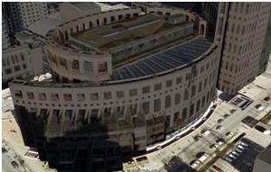
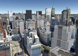
The 3D building layer makes changes only to notable buildings and structures of major cities. By selecting this option, the user can see both photorealistic and gray views. The photorealistic option enables additional detail and realism, whereas the gray option is ideal for less up-to-date computers, in which a 3D view is still desired.
Street View
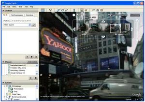
The street view layer is a very exciting and ever expanding feature of Google Earth. Selecting this option enables the user to literally explore the metropolitan streets of select cities across the globe, with a 360 degree panoramic view.
Borders and Labels
This layer is most useful when zoomed out of any given area and enables the user to see the outlines of countries, provinces, states, islands and coasts. In addition to this, each area is labeled with its appropriate name, including all bodies of water.
Traffic
This feature is only useful in heavily populated cities, and indicates real-time traffic conditions on main roads with the use of color indication. The speed limits of the roads are also indicated.
Weather
The weather layer is maintained by weather.comand provides updates every five minutes on current weather conditions across the globe. Not only is basic weather information presented, but also information provided by weather radar, which watches for oncoming storms and cloud cover conditions.
Galleries
The gallery layer is filled with abundant information and provides an array of photos and data from various sources. Many interests and organizations contribute to this layer of Google Earth and the galleries available for viewing range anywhere from volcano sites to YouTube contributions.
Ocean
The Ocean layer is basically a 3D map of the ocean floor, with all major basins and ocean ridges labeled. Several organizations contribute to this layer of Google Earth as well, providing information regarding marine wildlife, conservation zones and ocean observation stations.
Global Awareness
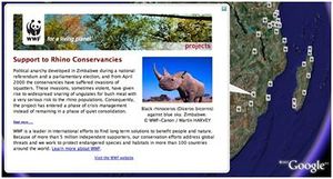
The Global Awareness layer is an excellent component of Google Earth that provides resources for global awareness. Many outreach and conservation program branches in all areas of the globe are displayed, including Green Peace, UNICEF and the World Wildlife Foundation. By simply clicking on a displayed global awareness icon, the user can learn all about the issue at hand and the organization working to defend it.
Places of Interest
This layer is very useful for those who wish to travel and provides local listings of businesses and services in the area. This component provides a wealth of information for tourists, and even provides reviews for dining spots across the region.
Advantages
Google Earth is a recently established, effective and informative atlas. The program can be used to display large databases of geological information, that can be transformed into various formats. Google Earth focuses on comprehensive mapping for the public which allows electronic access to all of the World’s greatest landmarks. Users are able to explore exciting areas of the world from their own homes, in addition to viewing regions in different time periods and exploring major components of the solar system. Zooming in on specific destinations gives direct access to the details of the world. Images are transformed into 3-D formats, allowing users to experience and visualize realistic details. Also, Google Earth includes building features which allow users to create their own personalized tours, routes and galleries.
> Free, informative and useful
> Easy to download
> Displays, in detail, the World's greatest landmarks
> Displays relatively up-to-date structure information
> Route planner
> Enables users to navigate through various different layers
> Allows users to explore different time periods of the land
> Enables exploration of Earth's oceans
> Enables exploration of the solar system
Disadvantages
Although Google Earth has many exciting advantages, it does also present several notable disadvantages.
> Not everywhere is properly mapped with good resolution
> Less developed countries are poorly presented on the maps
> Not all areas of the globe are covered, as some are restricted
> The images are not updated as often as some users would like
> Access is slow if computer specification is below standard
> Some people argue that the images are inaccurate
> Images appear too small
> Potential to be misused (terror threats / invasion of privacy)
Controversial Issues
Privacy
Google Earth has fueled much controversy, most notably with privacy matters. Privacy has been a major issue with many users because they believe Google Earth to be intrusive. The satellite images have an average resolution of 1000ft., allowing these images to be readily available to anyone flying over that region. Google Earth does not give an advantage in that sense, but it does allow others to explore an area without having to physically go there, and this worries some people because they say that this information could potentially be misused by others.
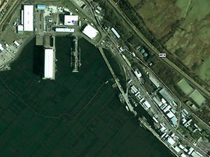
In Scotland, a secret naval base was exposed through Google Earth. The satellite images not only showed the exact location of the base but also showed, in detail, two Vanguard class submarines which can carry up to 16 nuclear armed missiles. On the images you could also see the sheds that were used to store the missiles.
Even though there are certain issues with the privacy of Google Earth, the creators have assured users that the information given on the maps are closely controlled and that they modify the resolution of certain parts of the globe, as they find necessary.
References
1. http://www.gearthblog.com/blog/archives/2009/03/google_earth_layers_1.html
2. http://netforbeginners.about.com/od/readerpicks/a/google_earth_2.htm
3. http://download-earth.org/installing-google-earth/installation-requirement-of-google-earth/
4. http://www.ciao.co.uk/Reviews/Google_Earth__6376520
5. http://www.foxnews.com/story/0,2933,506915,00.html
8. http://gallery.gilldownloads.com/images.php/i369_13ydkpv
9. http://google-earth.brothersoft.com/screenshots-1
10. http://www.ditii.com/2009/01/29/vancouver-in-google-earths-3d-buildings-layer/
